navigation and map line icon set - satellite view map stock illustrationsNavigation And Map Line Icon SetIcon Symbol, Flag, Satellite View
full view of the earth derived from avhrr and topographic data. - satellite view map stock illustrationsFull view of the Earth derived from AVHRR and topographic data.South America, Map, Europe
austria vector map - satellite view map stock illustrationsAustria Vector MapMap, Vienna - Austria, Salzburg
bering land bridge, illustration - satellite view map stock illustrationsBering Land Bridge, illustrationMap, USA, Old
numbers 0-nine royalty-free vector social networking and internet icon set - satellite view map stock illustrationsNumbers 0-nine royalty-free vector Social Networking and Internet Icon SetNumber
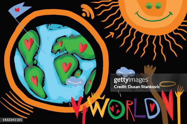
global love, peace and equality - satellite view map stock illustrationsGlobal love, peace and equalityGlobe - Navigational Equipment
globe world map dotted - satellite view map stock illustrationsGlobe World Map dottedAustralia, Concepts, World Map
seamless simple outline golf course map pattern - satellite view map stock illustrationsSeamless Simple Outline Golf Course Map PatternVector, Green - Golf Course, Plan - Document
satellite network earth - satellite view map stock illustrationsSatellite Network EarthGlobe - Navigational Equipment, Surveillance
global love, peace and equality - satellite view map stock illustrationsGlobal love, peace and equalityGlobe - Navigational Equipment, Love - Emotion
communications technology - satellite view map stock illustrationsCommunications TechnologyWorld Map, Globe - Navigational Equipment, Discussion
geometric world map collection - satellite view map stock illustrationsGeometric world map collectionGlobe - Navigational Equipment, USA
global communication - satellite view map stock illustrationsGlobal CommunicationGlobe - Navigational Equipment, Connection
an artist's depiction of planet earth catching on fire. - satellite view map stock illustrationsAn artist's depiction of planet Earth catching on fire.
satellite earth observation gradient fill color & paper-cut style icon design - satellite view map stock illustrationsSatellite Earth Observation Gradient Fill Color & Paper-Cut Style Icon Design
golf course tournament poster invitation design - satellite view map stock illustrationsGolf Course Tournament Poster Invitation Design
gps, location and communication icons - acme series - satellite view map stock illustrationsGps, Location and Communication Icons - Acme Series
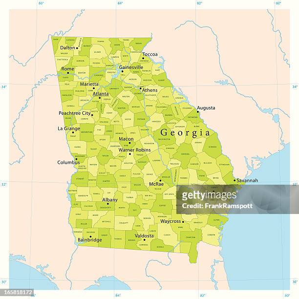
georgia state vector map - satellite view map stock illustrationsGeorgia State Vector MapMap, Georgia - US State, USA
earth planet in flame - satellite view map stock illustrationsEarth planet in flameClimate Change, Globe - Navigational Equipment, Map
gps tracking map illustration - satellite view map stock illustrationsGPS tracking map illustrationSatellite, Map, Map Pin Icon
location pin. icon for design. easily editable - satellite view map stock illustrationsLocation pin. Icon for design. Easily editable
navigation icons - smart series - satellite view map stock illustrationsNavigation Icons - Smart SeriesMap, Icon Symbol
seamless green golf course map pattern - satellite view map stock illustrationsSeamless green golf course map patternGolf Course, Map, Aerial View
seamless green golf course layout map pattern - satellite view map stock illustrationsSeamless Green Golf Course Layout Map Pattern
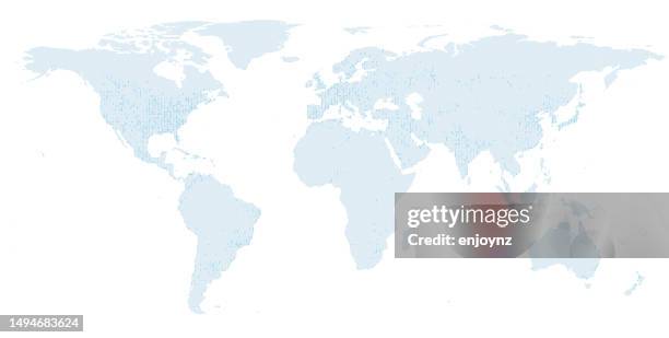
world map with data halftone overlay - satellite view map stock illustrationsWorld map with data halftone overlayMap, World Map, Global
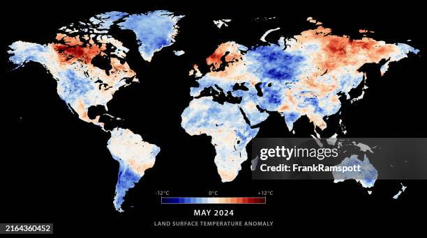
world map land surface temperature anomaly may 2024 - satellite view map stock illustrationsWorld Map Land Surface Temperature Anomaly May 2024Heat - Temperature, Map
navigation icon set. editable stroke weight. pixel perfect icons. - satellite view map stock illustrationsNavigation icon set. Editable stroke weight. Pixel perfect icons.Map, Icon Set, Road Map
radio waves over ankara city in turkiye - satellite view map stock illustrationsRadio waves over Ankara City in TurkiyeAnkara - Turkey, Map, Earthquake
world map land surface temperature anomaly march 2024 - satellite view map stock illustrationsWorld Map Land Surface Temperature Anomaly March 2024Climate Change, Map, World Map
set of planet earth and moon icon. - satellite view map stock illustrationsSet of planet earth and moon icon.Circle, Satellite View
antarctica map land surface temperature anomaly 12 months 2020 - satellite view map stock illustrationsAntarctica Map Land Surface Temperature Anomaly 12 Months 2020
globe on abstract background - satellite view map stock illustrationsGlobe on abstract backgroundSatellite View, Satellite, Connection
globe global communications - satellite view map stock illustrationsGlobe global communicationsGlobe - Navigational Equipment, Satellite View, USA
communications technology - satellite view map stock illustrationsCommunications TechnologySatellite View, Globe - Navigational Equipment
globe on abstract background - satellite view map stock illustrationsGlobe on abstract backgroundSatellite View, Satellite, Connection
map and navigation line icon set and banner design - satellite view map stock illustrationsMap and Navigation Line Icon Set and Banner DesignMap
geometric world map - satellite view map stock illustrationsGeometric world mapGlobe - Navigational Equipment, World Map, Backgrounds
map and navigation line icon - satellite view map stock illustrationsMap and Navigation Line IconDirection, Map, Icon Symbol
planet earth spreads love - satellite view map stock illustrationsPlanet Earth Spreads LoveIllustration, Love - Emotion, Satellite View
gps web icons - satellite view map stock illustrationsGPS Web IconsCommunications Tower, Satellite View
world map land surface temperature anomaly december 2024 - satellite view map stock illustrationsWorld Map Land Surface Temperature Anomaly December 2024Heat - Temperature, Map, World Map
world map circle template - satellite view map stock illustrationsWorld map circle templatePattern, Abstract, Africa
planet earth - satellite view map stock illustrationsPlanet EarthGlobe - Navigational Equipment, Satellite View, Atlantic Ocean
satellite communication - satellite view map stock illustrationsSatellite communicationGlobe - Navigational Equipment, Satellite, Satellite View
world map land surface temperature anomaly april 2025 - satellite view map stock illustrationsWorld Map Land Surface Temperature Anomaly April 2025Climate Change, Heat - Temperature, Red
global communications - satellite view map stock illustrationsGlobal CommunicationsGlobe - Navigational Equipment, Satellite View
world map land surface temperature anomaly may 2022 - satellite view map stock illustrationsWorld Map Land Surface Temperature Anomaly May 2022Heat - Temperature, Map
global communications - satellite view map stock illustrationsGlobal CommunicationsTechnology, Globe - Navigational Equipment, Satellite View
globes collection on green abstract background - satellite view map stock illustrationsGlobes Collection on Green Abstract BackgroundItaly, Sea, Map