chinese yuan on digital terrain map - elevation map lines stock videos & royalty-free footage00:06Chinese Yuan on Digital Terrain Map
global smart city communication network aerial view - elevation map lines stock videos & royalty-free footage00:06Global Smart City Communication Network Aerial ViewBandwidth, Abstract, Globe - Navigational Equipment
topographical map, animation - elevation map lines stock videos & royalty-free footage00:29Topographical map, animation
topographical map, animation - elevation map lines stock videos & royalty-free footage00:40Topographical map, animation
topographical map, animation - elevation map lines stock videos & royalty-free footage00:40Topographical map, animation
global smart city communication network aerial view - elevation map lines stock videos & royalty-free footage00:07Global Smart City Communication Network Aerial View
"moscow hails airmen who flew arctic," paramount news at bottom / title card: "first pictures to reach us of 56-hour non-stop flight of russian... - elevation map lines stock videos & royalty-free footage01:37Russian airmen Chkalov, Baydukov, Belyakov after transarctic flight; greeted by Soviet leader Stalin and given parade
people on ground seen through underside of airplane / pilot valery chkalov, co-pilot georgy baydukov and navigator alexander belyakov, people behind... - elevation map lines stock videos & royalty-free footage02:01Russian airmen Chkalov, Baydukov, Belyakov after transarctic flight; greeted by Joseph Stalin and given parade in MoscowCigarette, Airplane, Joseph Stalin
map of south america; venezuela / map of venezuela showing major cities / vs aerials road being built through jungle / vs men hacking at vegetation... - elevation map lines stock videos & royalty-free footage01:42Road and automobile bridge being built in mountains in VenezuelaVenezuela, Economy
animated of air travel concept - elevation map lines stock videos & royalty-free footage00:10Animated of Air travel concept
typed card describing clip / men wearing caps look over a map; a long line of armed soldiers are reviewed / a man wearing a gorillos side cap speaks... - elevation map lines stock videos & royalty-free footage01:03Spanish government troops leave Madrid for the front during the Spanish Civil WarSpain, Spanish Civil War
young girls reading world map in library - elevation map lines stock videos & royalty-free footage00:04Young girls reading world map in libraryEducation, Order, Child
desert road – aerial panorama of endless sand dunes - elevation map lines stock videos & royalty-free footage00:13Desert Road – Aerial Panorama of Endless Sand Dunes
anti-pylon battle lines forming as government demands green energy revolution; england: london: int tunnel engineers along on bicycles through london... - elevation map lines stock videos & royalty-free footage02:31Anti-pylon battle lines forming as government demands green energy revolutionSustainable Energy, Technology, Drone Point of View
digital data moving on earth - elevation map lines stock videos & royalty-free footage00:10Digital data moving on earth
digital data moving on earth - elevation map lines stock videos & royalty-free footage00:10Digital data moving on earthStock Market and Exchange
global connection lines - expanding network, night - global business, network security, spreading pandemic - 4k stock video - elevation map lines stock videos & royalty-free footage00:10Global Connection Lines - Expanding Network, Night - Global Business, Network Security, Spreading Pandemic - 4K stock videoConnect the Dots, World Map, Illuminated
futuristic topography map of terrain in real time - elevation map lines stock videos & royalty-free footage00:08Futuristic topography map of terrain in real time
human skin wrinkle reduction animation. - elevation map lines stock videos & royalty-free footage00:23Human skin wrinkle reduction animation.
human skin wrinkle reduction animation. - elevation map lines stock videos & royalty-free footage00:08Human skin wrinkle reduction animation.Animated Video
human skin wrinkle reduction animation. - elevation map lines stock videos & royalty-free footage00:23Human skin wrinkle reduction animation.Topology
human skin wrinkle reduction animation. - elevation map lines stock videos & royalty-free footage00:08Human skin wrinkle reduction animation.
aerial shot of bombers flying in formation over ocean / close shot of bombs under wing of bomber / shot from in front of two pilots in cockpit and of... - elevation map lines stock videos & royalty-free footage01:46British bombers carrying out bombing exercise over London testing city's air defense planUK
planes test london's air defence plan" / aerial shot of bombers flying in formation over ocean / close shot of bombs under wing of bomber / shot from... - elevation map lines stock videos & royalty-free footage02:01British bombers carry out bombing exercise over London, testing city's air defense planRAF, Bomb, London - England
an aerial perspective captures a peaceful rural landscape at twilight, with distant power lines marking the horizon - elevation map lines stock videos & royalty-free footage00:18An aerial perspective captures a peaceful rural landscape at twilight, with distant power lines marking the horizon
pakistan abstract 3d digital map - elevation map lines stock videos & royalty-free footage00:30Pakistan abstract 3d digital map
global connection lines world communications network - elevation map lines stock videos & royalty-free footage00:10Global connection lines world communications networkGlobe - Navigational Equipment, Planet - Space, Digitally Generated Image
a road cutting through a landscape with power lines overhead - elevation map lines stock videos & royalty-free footage00:13A road cutting through a landscape with power lines overheadCityscape
natural scenery with cars moving at village in ko yo island, songkhla province south of thailand - elevation map lines stock videos & royalty-free footage00:15Natural scenery with cars moving at village in Ko Yo island, Songkhla province south of Thailand
natural scenery with cars moving at village in ko yo island, songkhla province south of thailand - elevation map lines stock videos & royalty-free footage00:23Natural scenery with cars moving at village in Ko Yo island, Songkhla province south of Thailand
natural scenery with cars moving at village in ko yo island, songkhla province south of thailand - elevation map lines stock videos & royalty-free footage00:18Natural scenery with cars moving at village in Ko Yo island, Songkhla province south of Thailand
natural scenery with cars moving at village in ko yo island, songkhla province south of thailand - elevation map lines stock videos & royalty-free footage00:20Natural scenery with cars moving at village in Ko Yo island, Songkhla province south of Thailand
aerial view of budapest cityscape - elevation map lines stock videos & royalty-free footage00:11Aerial view of Budapest cityscapeBudapest, Suburb
aerial budapest city view and andrassy street - elevation map lines stock videos & royalty-free footage00:22Aerial Budapest city view and Andrassy StreetIn A Row, Hungary, Europe
tirana skanderbeg square from drone - elevation map lines stock videos & royalty-free footage00:07Tirana Skanderbeg Square from droneTirana, Albania
tirana skanderbeg square from drone - elevation map lines stock videos & royalty-free footage00:07Tirana Skanderbeg Square from droneAlbania, Tirana
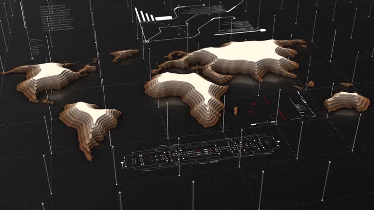
3d topographic world map - elevation map lines stock videos & royalty-free footage00:303D Topographic World map
3d topographic world map - elevation map lines stock videos & royalty-free footage00:303D Topographic World map
global network on planet earth. global business, flight routes, connection lines - elevation map lines stock videos & royalty-free footage00:24Global Network on Planet Earth. Global Business, Flight Routes, Connection Lines
global network on planet earth. global business, flight routes, connection lines - elevation map lines stock videos & royalty-free footage00:24Global Network on Planet Earth. Global Business, Flight Routes, Connection Lines
data lines emerging over planet earth, sunrise from space - europe, north africa, asia - technology, international business, climate - elevation map lines stock videos & royalty-free footage00:29Data Lines Emerging Over Planet Earth, Sunrise From Space - Europe, North Africa, Asia - Technology, International Business, ClimateGlobe - Navigational Equipment, Technology, Connection
reporter speaking / outline of map of us, "year of challenge" inside outline, then footage of factory, then footage of crowd / someone stepping on a... - elevation map lines stock videos & royalty-free footage02:59Paramount News film shows scenes of the US home front during World War IIWorld War II, Rationing, Women
zoom in on monochrome map of israel / palestine, gaza strip, west bank step by step, - elevation map lines stock videos & royalty-free footage00:15Zoom in on monochrome map of Israel / Palestine, Gaza Strip, West Bank step by step,Palestine, Satellite View
global connection lines world communications network - elevation map lines stock videos & royalty-free footage00:10Global connection lines world communications networkEurope, Global
technology global network global business, flight routes, connection lines - elevation map lines stock videos & royalty-free footage00:10Technology global network global business, flight routes, connection linesTechnology, Globe - Navigational Equipment, Planet - Space
technology global network global business, flight routes, connection lines - elevation map lines stock videos & royalty-free footage00:10Technology global network global business, flight routes, connection lines
technology global network global business, flight routes, connection lines - elevation map lines stock videos & royalty-free footage00:10Technology global network global business, flight routes, connection linesGlobal, Technology
technology global network global business, flight routes, connection lines - elevation map lines stock videos & royalty-free footage00:10Technology global network global business, flight routes, connection lines
technology global network global business, flight routes, connection lines - elevation map lines stock videos & royalty-free footage00:10Technology global network global business, flight routes, connection linesPlanet - Space, Globe - Navigational Equipment, Technology
technology global network global business, flight routes, connection lines - elevation map lines stock videos & royalty-free footage00:10Technology global network global business, flight routes, connection lines
housing estate in aerial top view - elevation map lines stock videos & royalty-free footage00:20Housing estate in aerial top view
housing village in aerial view - elevation map lines stock videos & royalty-free footage00:10Housing village in aerial view
housing village in aerial top view - elevation map lines stock videos & royalty-free footage00:14Housing village in aerial top view
housing village pattern in aerial top view - elevation map lines stock videos & royalty-free footage00:12Housing village pattern in aerial top view
transportation in suburb from aerial view - elevation map lines stock videos & royalty-free footage00:07Transportation in suburb from aerial view
transportation in suburb from aerial view - elevation map lines stock videos & royalty-free footage00:06Transportation in suburb from aerial view
transportation in suburb from aerial view - elevation map lines stock videos & royalty-free footage00:17Transportation in suburb from aerial view
transportation in suburb from aerial view - elevation map lines stock videos & royalty-free footage00:13Transportation in suburb from aerial view
transportation in suburb from aerial view - elevation map lines stock videos & royalty-free footage00:20Transportation in suburb from aerial view
transportation in suburb from aerial view - elevation map lines stock videos & royalty-free footage00:05Transportation in suburb from aerial view
transportation in suburb from aerial view - elevation map lines stock videos & royalty-free footage00:14Transportation in suburb from aerial view
transportation in suburb from aerial view - elevation map lines stock videos & royalty-free footage00:20Transportation in suburb from aerial view
transportation in suburb from aerial view - elevation map lines stock videos & royalty-free footage00:11Transportation in suburb from aerial view
transportation in suburb from aerial view - elevation map lines stock videos & royalty-free footage00:15Transportation in suburb from aerial view
transportation in suburb from aerial view - elevation map lines stock videos & royalty-free footage00:20Transportation in suburb from aerial view
transportation in suburb from aerial view - elevation map lines stock videos & royalty-free footage00:10Transportation in suburb from aerial view
transportation in suburb from aerial view - elevation map lines stock videos & royalty-free footage00:12Transportation in suburb from aerial view
transportation in suburb from aerial view - elevation map lines stock videos & royalty-free footage00:17Transportation in suburb from aerial view
transportation in suburb from aerial view - elevation map lines stock videos & royalty-free footage00:20Transportation in suburb from aerial view
transportation in suburb from aerial view - elevation map lines stock videos & royalty-free footage00:20Transportation in suburb from aerial view
transportation in suburb from aerial view - elevation map lines stock videos & royalty-free footage00:13Transportation in suburb from aerial view
transportation in suburb from aerial view - elevation map lines stock videos & royalty-free footage00:17Transportation in suburb from aerial view
transportation in suburb from aerial view - elevation map lines stock videos & royalty-free footage00:16Transportation in suburb from aerial view
with an elevated view, the drone captures the division created by the us/mexican border at tecate, emphasizing the contrast between two nations. - elevation map lines stock videos & royalty-free footage00:10With an elevated view, the drone captures the division created by the US/Mexican border at Tecate, emphasizing the contrast between two nations.
from high above, the drone captures the us/mexican border at tecate, where lines on a map become a visible reality. - elevation map lines stock videos & royalty-free footage00:23From high above, the drone captures the US/Mexican border at Tecate, where lines on a map become a visible reality.Dusk, Refugee, Crossing
at the us/mexican border in new mexico, the rio grande river meanders serenely, marking the natural boundary between the two nations, while the land stands witness to the complexities of geopolitics. - elevation map lines stock videos & royalty-free footage00:05At the US/Mexican border in New Mexico, the Rio Grande River meanders serenely, marking the natural boundary between the two nations, while the land stands witness to the complexities of geopolitics.
[clip from canadian propaganda film "soldiers all," from the series "canada carries on" by the national film board of canada; narration throughout by... - elevation map lines stock videos & royalty-free footage01:28The war has brought changes to the Royal Military College of CanadaWorld War II, British Flag, Woodland
[clip from "britain at bay," british propaganda film from the british ministry of information gpo film unit; narration throughout by j. b. priestley]... - elevation map lines stock videos & royalty-free footage01:42Clip from "Britain at Bay" propaganda film showing war effort in England in early part of World War IIUK, World War II, Military Recruit
topographic contour map, moving waves on black background - seamless loop background - 4k resolution - elevation map lines stock videos & royalty-free footage00:51Topographic Contour Map, Moving Waves On Black Background - Seamless Loop Background - 4K ResolutionSquiggle