historical topographic map of oceania, lithograph, published in 1897 - south pacific map stock illustrationsHistorical topographic map of Oceania, lithograph, published in 1897Map, Sea, Philippines
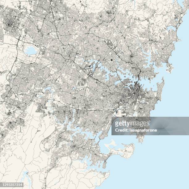
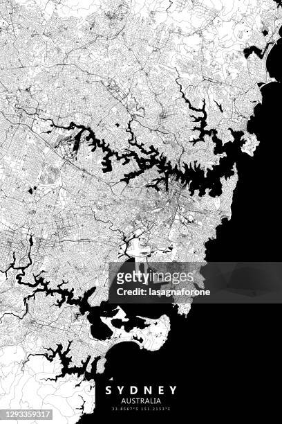
sydney, australia vector map - south pacific map stock illustrationsSydney, Australia Vector MapMap, Topography
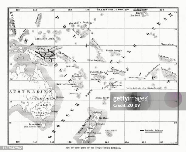
topographic maps of the former german colonies, lithograph, published 1897 - south pacific map stock illustrationsTopographic maps of the former German colonies, lithograph, published 1897Map, Mozambique, Imperialism
former german colonies in melanesia, wood engraving, published in 1885 - south pacific map stock illustrationsFormer German colonies in Melanesia, wood engraving, published in 1885Map, The Past
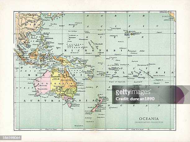
antique map of oceania - south pacific map stock illustrationsAntique Map of OceaniaMap, The Past, Old
map of samoan islands: savai'i, upolu, and tutuila, lithograph, 1897 - south pacific map stock illustrationsMap of Samoan islands: Savai'i, Upolu, and Tutuila, lithograph, 1897Map, Island
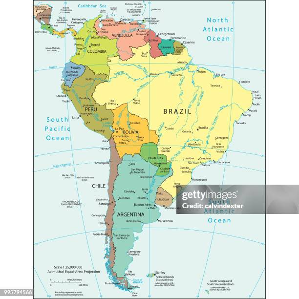
political map of south america - south pacific map stock illustrationsPolitical map of South AmericaMap, South America, Venezuela
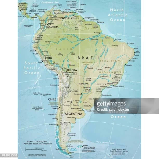
physical map of south america - south pacific map stock illustrationsPhysical map of South AmericaMap, South America, Brazil
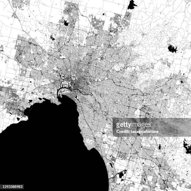
melbourne, victoria, australia vector map - south pacific map stock illustrationsMelbourne, Victoria, Australia Vector MapMelbourne - Australia, Map, Australia
antique map of oceania 1897 - south pacific map stock illustrationsAntique Map of Oceania 1897Map, Old-fashioned, Retro Style
sydney, australia vector map - south pacific map stock illustrationsSydney, Australia Vector MapMap, Vector, Topography
merchant ships from the time of louis xiv - south pacific map stock illustrationsMerchant ships from the time of Louis XIVDutch Culture, Ship, 17th Century
passage through the ice - south pacific map stock illustrationsPassage through the iceCold Temperature, Illustration, Alaska - US State
map of easter island- 19th century - south pacific map stock illustrationsMap of Easter Island- 19th Century
south pole map (antarctica) - south pacific map stock illustrationsSouth Pole Map (antarctica)Map, Vector, Iceberg - Ice Formation
melbourne, victoria, australia vector map - south pacific map stock illustrationsMelbourne, Victoria, Australia Vector MapMelbourne - Australia, Victoria - Australia, Map
antique map of australia and new zealand - south pacific map stock illustrationsAntique map of Australia and New ZealandAustralia, Map, History
van noort sailing the strait of magellan, engraving of 1600 - south pacific map stock illustrationsVan Noort Sailing the Strait of Magellan, Engraving of 1600Exploration, Engraving, Ship
blue map of antarctica and box of colored navigational icons - south pacific map stock illustrationsBlue map of Antarctica and box of colored navigational iconsVector, Map
south pole map (antarctica) - south pacific map stock illustrationsSouth Pole Map (antarctica)Globe - Navigational Equipment
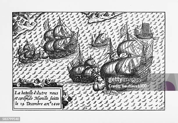
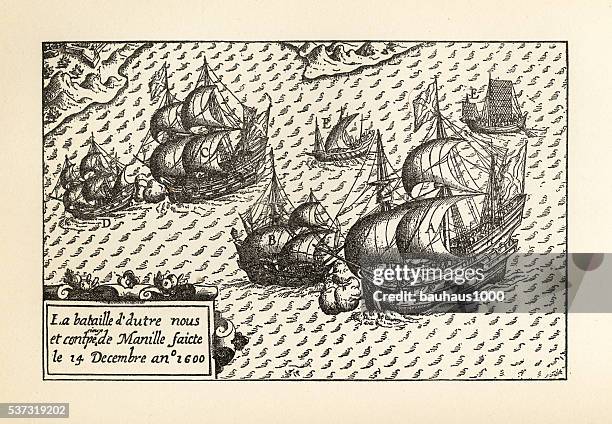
van noort landing in manila bay, philippines engraving, 1600 - south pacific map stock illustrationsVan Noort Landing in Manila Bay, Philippines Engraving, 1600Manila - Philippines
historical map of van noort at the island of principe, 1599 - south pacific map stock illustrationsHistorical Map of Van Noort at the Island of Principe, 1599Map
surat, capital of gujarat ,india in the 16th century - south pacific map stock illustrationsSurat, capital of Gujarat ,India in the 16th centuryOld-fashioned
antique map, oceania, australia, new zealand, pacific islands, papua new guinea, hawaii, philippine islands, 1890s, 19th century - south pacific map stock illustrationsAntique map, Oceania, Australia, New Zealand, Pacific Islands, Papua New Guinea, Hawaii, Philippine Islands, 1890s, 19th CenturyMap, Pacific Ocean, The Past
historical map of dutch navigators island of bali illustration - south pacific map stock illustrationsHistorical Map of Dutch Navigators Island of Bali IllustrationBali, Engraved Image, Engraving
engraving of van noort sailing the marianne islands, 1600 - south pacific map stock illustrationsEngraving of Van Noort Sailing the Marianne Islands, 1600Island
melbourne, victoria, australia vector map - south pacific map stock illustrationsMelbourne, Victoria, Australia Vector MapMelbourne - Australia, Map, Street
van noort sailing the strait of magellan, engraving of 1600 - south pacific map stock illustrationsVan Noort Sailing the Strait of Magellan, Engraving of 1600Dutch Culture, 16th Century, Ship
engraving of van noort landing in manila bay, philippines, 1600 - south pacific map stock illustrationsEngraving of Van Noort Landing in Manila Bay, Philippines, 1600Manila - Philippines, 17th Century, Spanish Culture
melbourne, victoria, australia vector map - south pacific map stock illustrationsMelbourne, Victoria, Australia Vector MapMelbourne - Australia, Map, Australia
high detailed antarctica vintage map - south pacific map stock illustrationsHigh detailed Antarctica vintage mapMap
high detailed antarctica blue map - south pacific map stock illustrationsHigh detailed Antarctica Blue mapMap
melbourne, victoria, australia vector map - south pacific map stock illustrationsMelbourne, Victoria, Australia Vector MapMelbourne - Australia, Map
map of south america (early 19th century steel engraving) - south pacific map stock illustrationsMap of South America (early 19th century steel engraving)Map, The Past, Old
island of principe historical map by van noort, circa 1598 - south pacific map stock illustrationsIsland of Principe Historical Map by Van Noort, Circa 1598Map
typhoon wutip 2019 track philippine sea infographic - south pacific map stock illustrationsTyphoon Wutip 2019 Track Philippine Sea Infographic
historical map af moorea and tahiti, wood engraving, published in 1897 - south pacific map stock illustrationsHistorical map af Moorea and Tahiti, wood engraving, published in 1897Tahiti, Map
south america map with blue globe and country outlines - south pacific map stock illustrationsSouth America Map with blue globe and country outlinesMap, Vector, South America
pentecost island is one of the 83 islands that make up the south pacific nation of vanuatu - south pacific map stock illustrationsPentecost Island is one of the 83 islands that make up the South Pacific nation of VanuatuMap
peros banhos, pedro dos banhos or baixos de pêro dos banhos in old maps, is a formerly inhabited atoll in the chagos archipelago of the british indian ocean territory - south pacific map stock illustrationsPeros Banhos, Pedro dos Banhos or Baixos de Pêro dos Banhos in old maps, is a formerly inhabited atoll in the Chagos Archipelago of the British Indian Ocean TerritoryMap
van noort sailing the marianne islands, engraving 1600 - south pacific map stock illustrationsVan Noort Sailing the Marianne Islands, Engraving 1600Old-fashioned, Old, Dutch Culture
historical map of dutch navigators expedition to sumatra illustration - south pacific map stock illustrationsHistorical Map of Dutch Navigators Expedition to Sumatra IllustrationIsland of Borneo, Indigenous Culture, Map
engraving of van noort landing in manila bay, philippines, 1600 - south pacific map stock illustrationsEngraving of Van Noort Landing in Manila Bay, Philippines, 1600Dutch Culture, Chart, Sailing
global recycle, arrow around the globe. - south pacific map stock illustrationsGlobal Recycle, Arrow around the globe.
antarctica map with navigation icons - south pacific map stock illustrationsAntarctica map with navigation icons
globe on stand with oceania. icon sticker on gray background - south pacific map stock illustrationsGlobe on stand with Oceania. Icon sticker on gray background
europe recycle icon - south pacific map stock illustrationsEurope Recycle IconRecycling, Globe - Navigational Equipment, Recycling Symbol
new zealand globe map background - south pacific map stock illustrationsNew Zealand Globe Map Background
flag of niue. vector waving flag background. high detailed realistic illustration - south pacific map stock illustrationsFlag of Niue. Vector Waving Flag Background. High detailed Realistic Illustration
location pin icon with the flag of french polynesia. map pointer symbol. location marker. vector illustration - south pacific map stock illustrationsLocation Pin Icon with the Flag of French Polynesia. Map pointer symbol. Location marker. Vector Illustration
new zealand globe map background - south pacific map stock illustrationsNew Zealand Globe Map Background
engraving of van noort sailing the marianne islands, 1600 - south pacific map stock illustrationsEngraving of Van Noort Sailing the Marianne Islands, 1600
historical map of van noort at the island of principe, 1599 - south pacific map stock illustrationsHistorical Map of Van Noort at the Island of Principe, 1599Village
globe on stand with asia. icon for design. easily editable - south pacific map stock illustrationsGlobe on stand with Asia. Icon for design. Easily editable
globe on stand with asia. icon for design. easily editable - south pacific map stock illustrationsGlobe on stand with Asia. Icon for design. Easily editable
globe on stand with oceania. icon for design. easily editable - south pacific map stock illustrationsGlobe on stand with Oceania. Icon for design. Easily editable