Map Of Alaska, Map Of Alaska, United States, With Inset Maps Of Sitka And The Aleutian Islands, Circa 1902, From The 10Th Edition Of Encyclopaedia...Map Of Alaska
gps car - geo mapping stock pictures, royalty-free photos & imagesgps carGlobal Positioning System, Car, Map
Symbolic photo travel, geography, finger on a map, Francesymbolic photo travel, geography, finger on a map, FranceMap, Africa
Competitors go over their maps just before the start of the race on day one of the the GeoQuest 48 hour Adventure race held around the Barrington...GeoQuest 48hr Adventure Race 2009
europe white map on teal plain background with shadow - geo mapping stock illustrationsEurope white map on teal plain background with shadow
California San Francisco: Panama-Pacific International Exposition General layout of the World's Fair from 1913 - Vintage property of ullstein bildUSA California San Francisco: Panama-Pacific International Exposition General layout of the World's Fair from 1913 - Vintage property of ullstein bildPanama, Map
Symbolic photo travel, geography, finger on a map, Italysymbolic photo travel, geography, finger on a map, ItalyMap
usa map icons - graphic icon series - geo mapping stock illustrationsUSA Map Icons - Graphic Icon SeriesUSA, Circle, Map
Plan of Brisbane town, Moreton Bay 1839 Geo. Barney Major. Creator: George Barney.Plan Of Brisbane Town
world globe in geographical - geo mapping stock pictures, royalty-free photos & imagesWorld Globe in GeographicalAfrica, Map, Globe - Navigational Equipment
Map Of Yosemite National Park, Map Of Yosemite National Park, Highlighting Major Parks And Other Features, Circa 1900, From The 10Th Edition Of...Map Of Yosemite National ParkCalifornia, Map, Yosemite National Park
GeoPark Terras de Cavaleiros map on display outside GeoPark tourism office during FAM Tour Terras de Cavaleiros 2019 on September 17, 2019 in Macedo...FAM Tour Terras de Cavaleiros 2019 in North Portugal
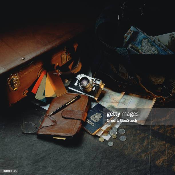
suitcase with passport - geo mapping stock pictures, royalty-free photos & imagesSuitcase with Passport
globe series - greenland - geo mapping stock illustrationsGlobe Series - GreenlandPlanet - Space, Globe - Navigational Equipment
globe series - north america - geo mapping stock illustrationsGlobe Series - North AmericaGray Color, Planet - Space, Globe - Navigational Equipment
globe series - mid east - geo mapping stock illustrationsGlobe Series - Mid EastGlobe - Navigational Equipment
europe white map on green plain background with shadow - geo mapping stock illustrationsEurope white map on green plain background with shadow
europe light map on green plain background with shadow - geo mapping stock illustrationsEurope light map on green plain background with shadow
Geo A. Bray Co. Map of a proposed area called "Mesmer City," which would have been developed in west Los Angeles, bounded by Sepulveda and Lincoln,...A 1924 Geo A. Bray Co. map of a proposed area called "Mesmer City," which would have been developed
Geo mapping of crime introduced by the LAPD. Jessica Robins Art Director with Lightray using a computer to access the website for projection during a...LOS ANGELES, CA. Geo mapping of crime introduced by the LAPD. Jessica Robins (left) Art Director wi
Geo mapping of crime introduced by the LAPD. Screen of a computer used to access the website for projection during a press conference, as Chief...LOS ANGELES, CA. Geo mapping of crime introduced by the LAPD. Screen of a computer used to access t
Polar flight of the LZ 127 'Graf Zeppelin': - large photogrammetric camera for vertical country photo shoots to produce accurate cartographic images...Polar flight of the LZ 127 'Graf Zeppelin': - large photogrammetric camera for vertical country photo shoots to produce accurate cartographic images of the Arctic - 25.07.1931 - Photographer: Walter Bosshard - Vintage property of ullstein bild
Libya Exploring expedition of the Count Laszlo Almasy, the british Wingcommander Hubert Penderell and the hungrian Dr. Kadar through the Libyan...Libya Exploring expedition of the Count Laszlo Almasy, the british Wingcommander Hubert Penderell and the hungrian Dr. Kadar through the Libyan Desert: The explorers composing new maps of the Libyan Desert (Series: 34 pictures) - ca. 1934 - Photograp
Polar flight of the LZ 127 'Graf Zeppelin': - officers studying maps during the travel - - Photographer: Walter Bosshard - Vintage property of...Polar flight of the LZ 127 'Graf Zeppelin': - officers studying maps during the travel - 28.07.1931 - Photographer: Walter Bosshard - Vintage property of ullstein bild
Libya Exploring expedition of the Count Laszlo Almasy, the british Wingcommander Hubert Penderell and the hungrian Dr. Kadar through the Libyan...Libya Exploring expedition of the Count Laszlo Almasy, the british Wingcommander Hubert Penderell and the hungrian Dr. Kadar through the Libyan Desert: Two expedition members looking at a map (Series: 34 pictures) - ca, 1934 - Photographer: Hans
Germany Berlin Treptow - centre of science and research Adlershof, former GDR tv and radio station, now media centreGermany Berlin Treptow (Treptow-Koepenick) - centre of science and research Adlershof, former GDR tv and radio station, now media centre
Symbolic photo travel, geography, finger on a map, Majorca, Balearic Islandssymbolic photo travel, geography, finger on a map, Majorca, Balearic Islands
Germany Berlin Mitte - tourists reading a map at Friedrichstrasse -Germany Berlin Mitte - tourists reading a map at Friedrichstrasse - 11.06.2010
Symbolic photo travel, geography, finger on a map, Greecesymbolic photo travel, geography, finger on a map, Greece
Rainer Kind, professor of geophysics, points to a map displaying the propagation of seismic waves after the Sumatra quake, on 14 January 2005 at the...Rainer Kind, professor for geophysics, p
Rainer Kind, professor for geophysics, points on a map displaying the propagation of the seismic waves after the Sumatra quake, 14 January 2005 at...Rainer Kind, professor for geophysics, p
Geo-hydrographic map of the world, from the Atlas nouveau contenant toutes les parties du monde , by Alexis-Hubert Jaillot and Nicolas Sanson ,...Geo-hydrographic map of the worldWorld Map
Rainer Kind, professor for geophysics, points on a map displaying the propagation of the seismic waves after the Sumatra quake, 14 January 2005 at...GERMANY-ASIA-QUAKE-SCIENCE-ALERT
u.s.a map icon flat graphic design - geo mapping stock illustrationsU.S.A Map Icon Flat Graphic DesignUSA
Staff Photo by John Ewing: 20071213 -- Thursday, December 13, 2007 -- .Brian Danz, a GPS training specialist at DeLorme in Yarmouth, demonstrates his...Brian Danz, a GPS training specialist at DeLorme in Yarmouth, demonstrates his company's newest GPS
Staff Photo by John Ewing: 20071213 -- Thursday, December 13, 2007 -- .Brian Danz, a GPS training specialist at DeLorme in Yarmouth, looks over some...Brian Danz, a GPS training specialist at DeLorme in Yarmouth, looks over some of the novelty items l
camera equipment on a google street view car - geo mapping stock pictures, royalty-free photos & imagesCamera equipment on a Google Street View car
Part of a biblical genealogy with maps , Carte pour conduire à l'inteligence de l'histoire sacrée, qui renferme en abregé la genealogie, la...Part of a biblical genealogy with maps (no. 2), Carte pour conduire à l'inteligence de l'histoire sacrée, qui renferme en abregé la genealogie, la geographie, et la chronologie de l'histoire sainte (title on object), Part of a biblical genealogy and geo
floating space tin can on blue vivid gradient background - geo mapping stock pictures, royalty-free photos & imagesFloating space tin can on blue vivid gradient background
a unique rock formation in the eastern sierra mountains of california - geo mapping stock pictures, royalty-free photos & imagesA unique rock formation in the eastern Sierra Mountains of California
State of Arkansas 1886. Compiled from the official records of the General Land Office and other sources by Geo U. Mayo, Chief of Draughting Div. G....State of Arkansas 1886