Chart of the North Atlantic, 1902. Showing North and Central America, West Africa and Western Europe, and transatlantic shipping routes. From The...
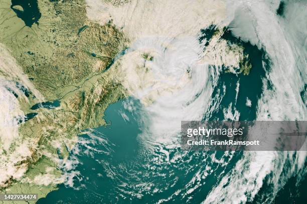
hurricane fiona cloud map nova scotia 3d render neutral - north atlantic ocean map stock pictures, royalty-free photos & images
hurricane fiona cloud map nova scotia 3d render color - north atlantic ocean map stock pictures, royalty-free photos & images
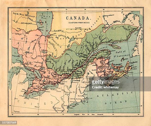
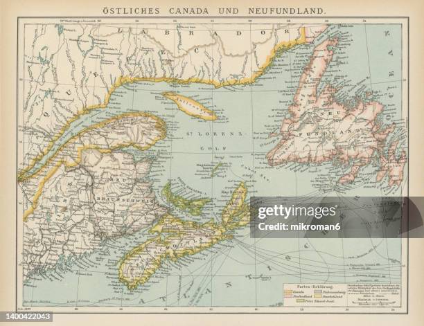
mid-victorian map of canadian eastern provinces - north atlantic ocean map stock pictures, royalty-free photos & images
Map of the North Atlantic Ocean. Map showing western Europen and Iceland, Greenland, eastern Canada and the United States, Central American and the...
old map of map of eastern canada and newfoundland - north atlantic ocean map stock pictures, royalty-free photos & images
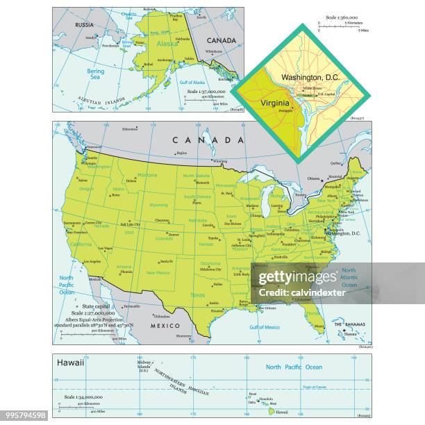
map of the united states of america with states and major cities - north atlantic ocean map stock illustrations
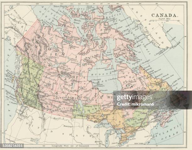
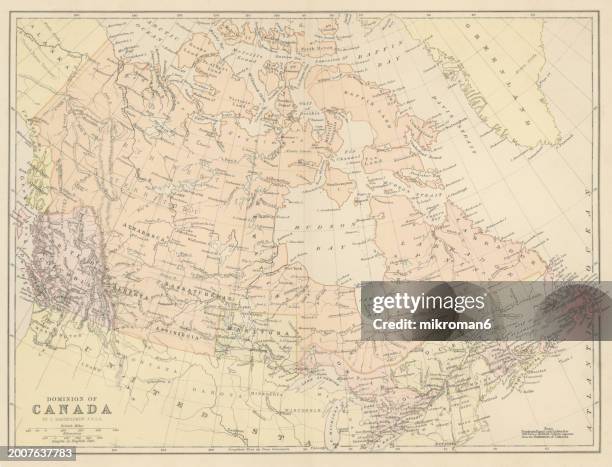
old chromolithograph map of dominion of canada - north atlantic ocean map stock pictures, royalty-free photos & images
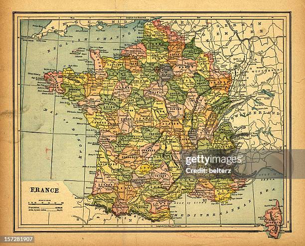
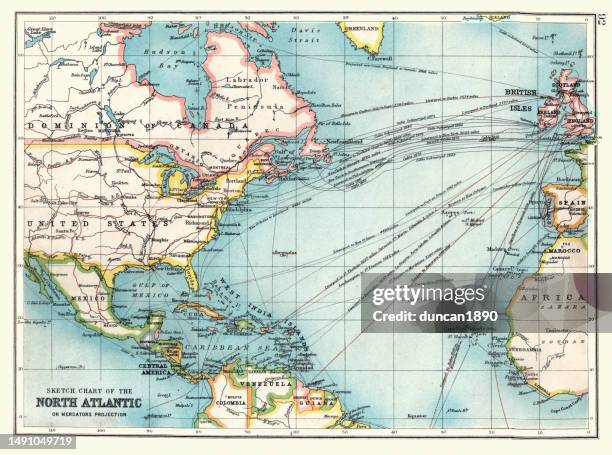
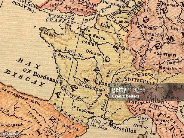
old sketch chart of the north atlantic on mercator projection, shipping routes, europe, north and south america, 1890s, 19th century - north atlantic ocean map stock illustrations
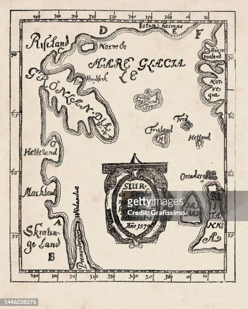
map of america greenland ireland and great britain 1570 by sigur stephanius - north atlantic ocean map stock illustrations
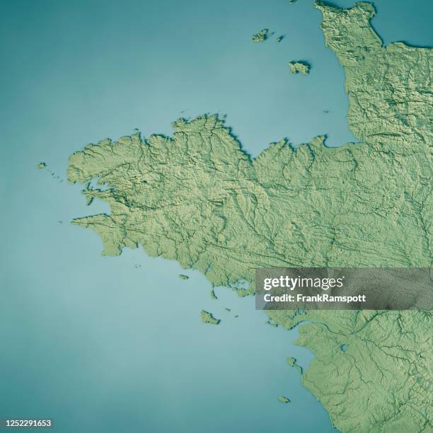
brittany 3d render topographic map color - north atlantic ocean map stock pictures, royalty-free photos & images
old chromolithograph map of canada (eastern provinces) and newfoundland - north atlantic ocean map stock pictures, royalty-free photos & images
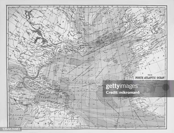
old map of north atlantic ocean, published 1894. antique illustration, popular encyclopedia published 1894. copyright has expired on this artwork - north atlantic ocean map stock pictures, royalty-free photos & images
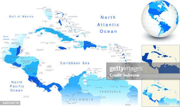
central america map with blue globe and country outlines - north atlantic ocean map stock illustrations
hurricane irene 2011 track north atlantic ocean infographic - north atlantic ocean map stock illustrations
antique map of maritime provinces of canada - 19th century - north atlantic ocean map stock illustrations
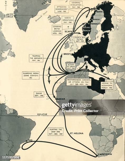
Map showing the movements of 'HMS Ark Royal', 1939-1941, . Map of the Atlantic Ocean, western Europe and Africa, indicating journeys and principal...
old chromolithograph map of dominion of canada - north atlantic ocean map stock pictures, royalty-free photos & images
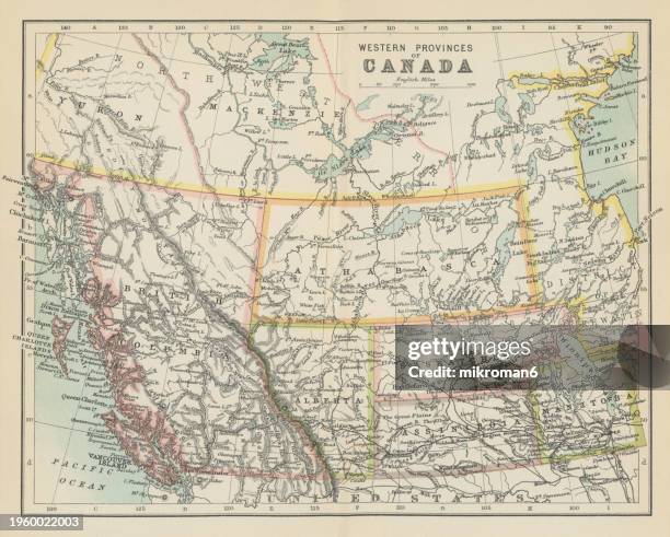
old chromolithograph map of western provinces of canada - north atlantic ocean map stock pictures, royalty-free photos & images
old chromolithograph map of province of quebec, one of the thirteen provinces and territories of canada - north atlantic ocean map stock pictures, royalty-free photos & images
hurricane chris 2018 track north atlantic ocean infographic - north atlantic ocean map stock illustrations
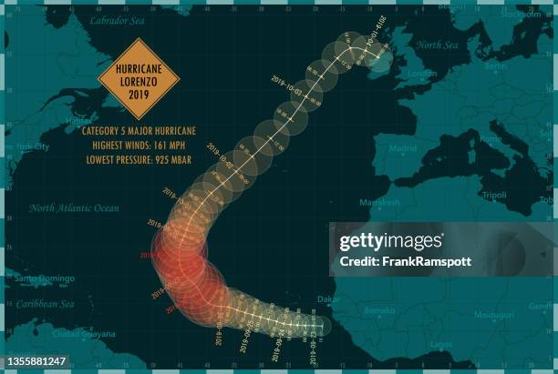
hurricane lorenzo 2019 track north atlantic ocean infographic - north atlantic ocean map stock illustrations
In this handout GOES-13 satellite image provided by the NASA/GOES Project, captured at 7:45 a.m. EDT, Hurricane Earl moves north-northwest of San...
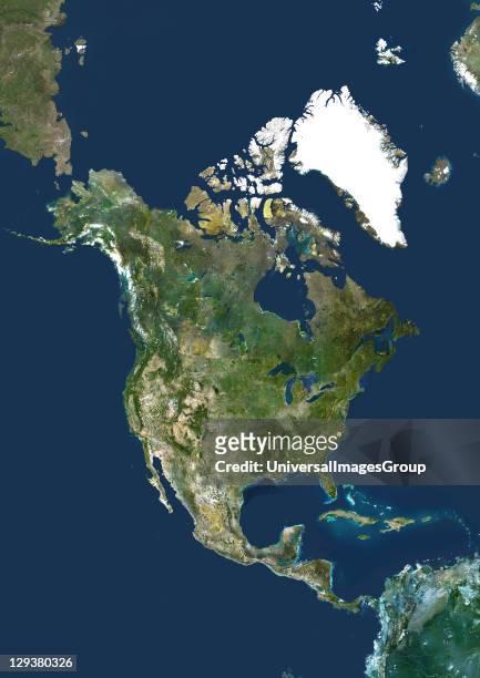
North America. True colour satellite image centred on North America. The North Pole is at top centre. Water is blue, vegetation is green, arid areas...
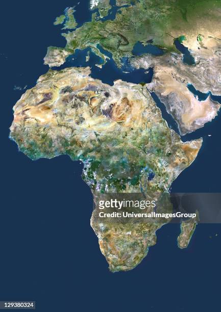
Africa. True colour satellite image centred on Africa. North is at top. Water is blue, vegetation is green, arid areas are brown, and snow and ice...
Earth. True colour satellite image of the Earth, centred on Africa. North is at top. Water is blue, vegetation is green, arid areas are brown, and...
map of heimaey, westman islands, iceland - north atlantic ocean map stock pictures, royalty-free photos & images
Earth. True colour satellite image of the Earth, centred on North America. The North Pole is at upper centre. Water is blue, vegetation is green,...