engineer working at renewable energy site wind turbines examining blueprint surveying instrument mounted tripod ensuring accurate land measurements practices in environmental industrial. - cartography geodesy stock videos & royalty-free footage00:20Engineer working at renewable energy site wind turbines examining blueprint surveying instrument mounted tripod ensuring accurate land measurements practices in environmental industrial.Engineering, Surveyor, Construction Site
topographic contour map, moving waves on black background - seamless loop background - 4k resolution - cartography geodesy stock videos & royalty-free footage00:51Topographic Contour Map, Moving Waves On Black Background - Seamless Loop Background - 4K ResolutionTopography, Topographic Map, Map
surveyor or engineer operating theodolite a precision instrument a tripod measuring background construction large piles of dirt and heavy machinery, including excavators the field of civil engineering and land development. - cartography geodesy stock videos & royalty-free footage00:16Surveyor or Engineer operating theodolite a precision instrument a tripod measuring background construction large piles of dirt and heavy machinery, including excavators the field of civil engineering and land development.Surveyor, Questionnaire, Construction Site
asian female civil engineer examining data and looking camera on railway bridge construction site during evening progress using technology and measurement tools to support accuracy. - cartography geodesy stock videos & royalty-free footage00:14Asian female Civil engineer examining data and looking camera on railway bridge construction site during evening progress using technology and measurement tools to support accuracy.Geodesy, Construction Worker, Digital Tablet
surveyor measuring and checking blueprints on a building construction site. engineering and land surveying for express way development - cartography geodesy stock videos & royalty-free footage00:11Surveyor measuring and checking blueprints on a building construction site. Engineering and land surveying for Express way developmentGeodesy
asian female civil engineer examining project data on railway bridge construction site using technology and measurement equipment to support accuracy. surveyor reviewing rail position data. - cartography geodesy stock videos & royalty-free footage00:12Asian female Civil engineer examining project data on railway bridge construction site using technology and measurement equipment to support accuracy. Surveyor reviewing rail position data.Construction Vehicle, Geodesy
pixelated texture of a geometric stylized rocky surface - cartography geodesy stock videos & royalty-free footage00:20Pixelated texture of a geometric stylized rocky surfaceAbstract, Topography, Map
two civil engineers conduct a land survey at a pipeline construction site using a theodolite - cartography geodesy stock videos & royalty-free footage00:14Two civil engineers conduct a land survey at a pipeline construction site using a theodoliteExpertise, Archaeology, Map
measuring with gnss equipment - cartography geodesy stock videos & royalty-free footage00:11Measuring with GNSS EquipmentGeographic Information System, Surveyor, Map
1950 b/w montage men studying ortophotos, soldiers cutting through thicket, surveyors with theodolite, audio - cartography geodesy stock videos & royalty-free footage00:401950 B/W MONTAGE Men studying ortophotos, soldiers cutting through thicket, surveyors with theodolite, AUDIOBolivia
road survey engineer and surveyor’s telescope at new road construction site - cartography geodesy stock videos & royalty-free footage00:27Road survey engineer and surveyor’s telescope at new road construction siteTopography, Surveyor
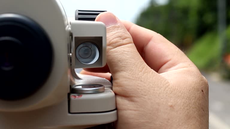
surveyor’s telescope at new road construction site - cartography geodesy stock videos & royalty-free footage00:22Surveyor’s telescope at new road construction siteSurveyor, Topography, Theodolite
road survey engineer adjustable surveyor’s telescope at new road construction site - cartography geodesy stock videos & royalty-free footage00:27Road survey engineer adjustable surveyor’s telescope at new road construction siteRoad, Surveyor, Land
road survey engineer adjustable surveyor’s telescope at new road construction site - cartography geodesy stock videos & royalty-free footage00:24Road survey engineer adjustable surveyor’s telescope at new road construction site
worker use surveyor’s telescope at new road construction site - cartography geodesy stock videos & royalty-free footage00:25worker use surveyor’s telescope at new road construction siteRoad, Surveyor, Land
road survey engineer send signal to worker in new road construction site - cartography geodesy stock videos & royalty-free footage00:26Road survey engineer send signal to worker in new road construction site
geospatial intelligence concept, ai analyzing mountain terrain with data layers - cartography geodesy stock videos & royalty-free footage00:17Geospatial Intelligence Concept, AI Analyzing Mountain Terrain with Data Layers
surveyor measuring and checking blueprints on a building construction site. engineering and land surveying for express way development - cartography geodesy stock videos & royalty-free footage00:21Surveyor measuring and checking blueprints on a building construction site. Engineering and land surveying for Express way development
surveyor measuring and checking blueprints on a building construction site. engineering and land surveying for express way development - cartography geodesy stock videos & royalty-free footage00:16Surveyor measuring and checking blueprints on a building construction site. Engineering and land surveying for Express way development
surveyor measuring and checking blueprints on a building construction site. engineering and land surveying for express way development - cartography geodesy stock videos & royalty-free footage00:14Surveyor measuring and checking blueprints on a building construction site. Engineering and land surveying for Express way development
surveyor measuring and checking blueprints on a building construction site. engineering and land surveying for express way development - cartography geodesy stock videos & royalty-free footage00:24Surveyor measuring and checking blueprints on a building construction site. Engineering and land surveying for Express way development
surveyor measuring and checking blueprints on a building construction site. engineering and land surveying for express way development - cartography geodesy stock videos & royalty-free footage00:21Surveyor measuring and checking blueprints on a building construction site. Engineering and land surveying for Express way development
surveyor measuring and checking blueprints on a building construction site. engineering and land surveying for express way development - cartography geodesy stock videos & royalty-free footage00:20Surveyor measuring and checking blueprints on a building construction site. Engineering and land surveying for Express way development
surveyor measuring and checking blueprints on a building construction site. engineering and land surveying for express way development - cartography geodesy stock videos & royalty-free footage00:21Surveyor measuring and checking blueprints on a building construction site. Engineering and land surveying for Express way development
surveyor measuring and checking blueprints on a building construction site. engineering and land surveying for express way development - cartography geodesy stock videos & royalty-free footage00:15Surveyor measuring and checking blueprints on a building construction site. Engineering and land surveying for Express way development
surveyor measuring and checking blueprints on a building construction site. engineering and land surveying for express way development - cartography geodesy stock videos & royalty-free footage00:22Surveyor measuring and checking blueprints on a building construction site. Engineering and land surveying for Express way development
surveyor measuring and checking blueprints on a building construction site. engineering and land surveying for express way development - cartography geodesy stock videos & royalty-free footage00:29Surveyor measuring and checking blueprints on a building construction site. Engineering and land surveying for Express way development
surveyor measuring and checking blueprints on a building construction site. engineering and land surveying for express way development - cartography geodesy stock videos & royalty-free footage00:16Surveyor measuring and checking blueprints on a building construction site. Engineering and land surveying for Express way development
surveyor measuring and checking blueprints on a building construction site. engineering and land surveying for express way development - cartography geodesy stock videos & royalty-free footage00:21Surveyor measuring and checking blueprints on a building construction site. Engineering and land surveying for Express way development
surveyor measuring and checking blueprints on a building construction site. engineering and land surveying for express way development - cartography geodesy stock videos & royalty-free footage00:22Surveyor measuring and checking blueprints on a building construction site. Engineering and land surveying for Express way development
surveyor measuring and checking blueprints on a building construction site. engineering and land surveying for express way development - cartography geodesy stock videos & royalty-free footage00:13Surveyor measuring and checking blueprints on a building construction site. Engineering and land surveying for Express way development
surveyor measuring and checking blueprints on a building construction site. engineering and land surveying for express way development - cartography geodesy stock videos & royalty-free footage00:18Surveyor measuring and checking blueprints on a building construction site. Engineering and land surveying for Express way development
surveyor measuring and checking blueprints on a building construction site. engineering and land surveying for express way development - cartography geodesy stock videos & royalty-free footage00:12Surveyor measuring and checking blueprints on a building construction site. Engineering and land surveying for Express way development
civil or construction engineer uses a survey camera and auto level to conduct precise measurements and assessments at a construction site, ensuring accuracy in the building process - cartography geodesy stock videos & royalty-free footage00:08Civil or construction engineer uses a survey camera and auto level to conduct precise measurements and assessments at a construction site, ensuring accuracy in the building process
civil or construction engineer uses a survey camera and auto level to conduct precise measurements and assessments at a construction site, ensuring accuracy in the building process - cartography geodesy stock videos & royalty-free footage00:09Civil or construction engineer uses a survey camera and auto level to conduct precise measurements and assessments at a construction site, ensuring accuracy in the building process
civil or construction engineer uses a survey camera and auto level to conduct precise measurements and assessments at a construction site, ensuring accuracy in the building process - cartography geodesy stock videos & royalty-free footage00:10Civil or construction engineer uses a survey camera and auto level to conduct precise measurements and assessments at a construction site, ensuring accuracy in the building process
civil or construction engineer uses a survey camera and auto level to conduct precise measurements and assessments at a construction site, ensuring accuracy in the building process - cartography geodesy stock videos & royalty-free footage00:09Civil or construction engineer uses a survey camera and auto level to conduct precise measurements and assessments at a construction site, ensuring accuracy in the building process
civil or construction engineer uses a survey camera and auto level to conduct precise measurements and assessments at a construction site, ensuring accuracy in the building process - cartography geodesy stock videos & royalty-free footage00:11Civil or construction engineer uses a survey camera and auto level to conduct precise measurements and assessments at a construction site, ensuring accuracy in the building process
civil or construction engineer uses a survey camera and auto level to conduct precise measurements and assessments at a construction site, ensuring accuracy in the building process - cartography geodesy stock videos & royalty-free footage00:11Civil or construction engineer uses a survey camera and auto level to conduct precise measurements and assessments at a construction site, ensuring accuracy in the building process
civil or construction engineer uses a survey camera and auto level to conduct precise measurements and assessments at a construction site, ensuring accuracy in the building process - cartography geodesy stock videos & royalty-free footage00:12Civil or construction engineer uses a survey camera and auto level to conduct precise measurements and assessments at a construction site, ensuring accuracy in the building process
civil or construction engineer uses a survey camera and auto level to conduct precise measurements and assessments at a construction site, ensuring accuracy in the building process - cartography geodesy stock videos & royalty-free footage00:11Civil or construction engineer uses a survey camera and auto level to conduct precise measurements and assessments at a construction site, ensuring accuracy in the building process
civil or construction engineer uses a survey camera and auto level to conduct precise measurements and assessments at a construction site, ensuring accuracy in the building process - cartography geodesy stock videos & royalty-free footage00:11Civil or construction engineer uses a survey camera and auto level to conduct precise measurements and assessments at a construction site, ensuring accuracy in the building process
civil or construction engineer uses a survey camera and auto level to conduct precise measurements and assessments at a construction site, ensuring accuracy in the building process - cartography geodesy stock videos & royalty-free footage00:11Civil or construction engineer uses a survey camera and auto level to conduct precise measurements and assessments at a construction site, ensuring accuracy in the building process
civil or construction engineer uses a survey camera and auto level to conduct precise measurements and assessments at a construction site, ensuring accuracy in the building process - cartography geodesy stock videos & royalty-free footage00:13Civil or construction engineer uses a survey camera and auto level to conduct precise measurements and assessments at a construction site, ensuring accuracy in the building process
civil or construction engineer uses a survey camera and auto level to conduct precise measurements and assessments at a construction site, ensuring accuracy in the building process - cartography geodesy stock videos & royalty-free footage00:12Civil or construction engineer uses a survey camera and auto level to conduct precise measurements and assessments at a construction site, ensuring accuracy in the building process
civil or construction engineer uses a survey camera and auto level to conduct precise measurements and assessments at a construction site, ensuring accuracy in the building process - cartography geodesy stock videos & royalty-free footage00:14Civil or construction engineer uses a survey camera and auto level to conduct precise measurements and assessments at a construction site, ensuring accuracy in the building process
civil or construction engineer uses a survey camera and auto level to conduct precise measurements and assessments at a construction site, ensuring accuracy in the building process - cartography geodesy stock videos & royalty-free footage00:13Civil or construction engineer uses a survey camera and auto level to conduct precise measurements and assessments at a construction site, ensuring accuracy in the building process
civil or construction engineer uses a survey camera and auto level to conduct precise measurements and assessments at a construction site, ensuring accuracy in the building process - cartography geodesy stock videos & royalty-free footage00:15Civil or construction engineer uses a survey camera and auto level to conduct precise measurements and assessments at a construction site, ensuring accuracy in the building process
civil or construction engineer uses a survey camera and auto level to conduct precise measurements and assessments at a construction site, ensuring accuracy in the building process - cartography geodesy stock videos & royalty-free footage00:16Civil or construction engineer uses a survey camera and auto level to conduct precise measurements and assessments at a construction site, ensuring accuracy in the building process
civil or construction engineer uses a survey camera and auto level to conduct precise measurements and assessments at a construction site, ensuring accuracy in the building process - cartography geodesy stock videos & royalty-free footage00:16Civil or construction engineer uses a survey camera and auto level to conduct precise measurements and assessments at a construction site, ensuring accuracy in the building process
civil or construction engineer uses a survey camera and auto level to conduct precise measurements and assessments at a construction site, ensuring accuracy in the building process - cartography geodesy stock videos & royalty-free footage00:16Civil or construction engineer uses a survey camera and auto level to conduct precise measurements and assessments at a construction site, ensuring accuracy in the building process
civil or construction engineer uses a survey camera and auto level to conduct precise measurements and assessments at a construction site, ensuring accuracy in the building process - cartography geodesy stock videos & royalty-free footage00:17Civil or construction engineer uses a survey camera and auto level to conduct precise measurements and assessments at a construction site, ensuring accuracy in the building process
civil or construction engineer uses a survey camera and auto level to conduct precise measurements and assessments at a construction site, ensuring accuracy in the building process - cartography geodesy stock videos & royalty-free footage00:18Civil or construction engineer uses a survey camera and auto level to conduct precise measurements and assessments at a construction site, ensuring accuracy in the building process
civil or construction engineer uses a survey camera and auto level to conduct precise measurements and assessments at a construction site, ensuring accuracy in the building process - cartography geodesy stock videos & royalty-free footage00:22Civil or construction engineer uses a survey camera and auto level to conduct precise measurements and assessments at a construction site, ensuring accuracy in the building process
civil or construction engineer uses a survey camera and auto level to conduct precise measurements and assessments at a construction site, ensuring accuracy in the building process - cartography geodesy stock videos & royalty-free footage00:28Civil or construction engineer uses a survey camera and auto level to conduct precise measurements and assessments at a construction site, ensuring accuracy in the building process
civil or construction engineer uses a survey camera and auto level to conduct precise measurements and assessments at a construction site, ensuring accuracy in the building process - cartography geodesy stock videos & royalty-free footage00:21Civil or construction engineer uses a survey camera and auto level to conduct precise measurements and assessments at a construction site, ensuring accuracy in the building process
lidar drone mapping. uav aerial surveying - cartography geodesy stock videos & royalty-free footage00:15LiDAR Drone Mapping. UAV Aerial Surveying
engineers survey wind farm site using theodolite, digital tablet and walkie-talkie. team in high-visibility jackets and hardhats work amid operating wind turbines. - cartography geodesy stock videos & royalty-free footage00:19Engineers Survey Wind Farm Site Using Theodolite, Digital Tablet And Walkie-Talkie. Team In High-Visibility Jackets And Hardhats Work Amid Operating Wind Turbines.
surveyor measuring and checking blueprints on a building construction site. engineering and land surveying for express way development - cartography geodesy stock videos & royalty-free footage00:27Surveyor measuring and checking blueprints on a building construction site. Engineering and land surveying for Express way development
surveyor measuring and checking blueprints on a building construction site. engineering and land surveying for express way development - cartography geodesy stock videos & royalty-free footage00:21Surveyor measuring and checking blueprints on a building construction site. Engineering and land surveying for Express way development
surveyor measuring and checking blueprints on a building construction site. engineering and land surveying for express way development - cartography geodesy stock videos & royalty-free footage00:16Surveyor measuring and checking blueprints on a building construction site. Engineering and land surveying for Express way development
surveyor measuring and checking blueprints on a building construction site. engineering and land surveying for express way development - cartography geodesy stock videos & royalty-free footage00:18Surveyor measuring and checking blueprints on a building construction site. Engineering and land surveying for Express way development
surveyor measuring and checking blueprints on a building construction site. engineering and land surveying for express way development - cartography geodesy stock videos & royalty-free footage00:22Surveyor measuring and checking blueprints on a building construction site. Engineering and land surveying for Express way development
surveyor measuring and checking blueprints on a building construction site. engineering and land surveying for express way development - cartography geodesy stock videos & royalty-free footage00:20Surveyor measuring and checking blueprints on a building construction site. Engineering and land surveying for Express way development
surveyor measuring and checking blueprints on a building construction site. engineering and land surveying for express way development - cartography geodesy stock videos & royalty-free footage00:18Surveyor measuring and checking blueprints on a building construction site. Engineering and land surveying for Express way development
surveyor measuring and checking blueprints on a building construction site. engineering and land surveying for express way development - cartography geodesy stock videos & royalty-free footage00:25Surveyor measuring and checking blueprints on a building construction site. Engineering and land surveying for Express way development
surveyor measuring and checking blueprints on a building construction site. engineering and land surveying for express way development - cartography geodesy stock videos & royalty-free footage00:25Surveyor measuring and checking blueprints on a building construction site. Engineering and land surveying for Express way development
surveyor measuring and checking blueprints on a building construction site. engineering and land surveying for express way development - cartography geodesy stock videos & royalty-free footage00:21Surveyor measuring and checking blueprints on a building construction site. Engineering and land surveying for Express way development
surveyor measuring and checking blueprints on a building construction site. engineering and land surveying for express way development - cartography geodesy stock videos & royalty-free footage00:21Surveyor measuring and checking blueprints on a building construction site. Engineering and land surveying for Express way development
surveyor measuring and checking blueprints on a building construction site. engineering and land surveying for express way development - cartography geodesy stock videos & royalty-free footage00:16Surveyor measuring and checking blueprints on a building construction site. Engineering and land surveying for Express way development
surveyor measuring and checking blueprints on a building construction site. engineering and land surveying for express way development - cartography geodesy stock videos & royalty-free footage00:25Surveyor measuring and checking blueprints on a building construction site. Engineering and land surveying for Express way development
surveyor measuring and checking blueprints on a building construction site. engineering and land surveying for express way development - cartography geodesy stock videos & royalty-free footage00:22Surveyor measuring and checking blueprints on a building construction site. Engineering and land surveying for Express way development
surveyor measuring and checking blueprints on a building construction site. engineering and land surveying for express way development - cartography geodesy stock videos & royalty-free footage00:20Surveyor measuring and checking blueprints on a building construction site. Engineering and land surveying for Express way development
surveyor measuring and checking blueprints on a building construction site. engineering and land surveying for express way development - cartography geodesy stock videos & royalty-free footage00:20Surveyor measuring and checking blueprints on a building construction site. Engineering and land surveying for Express way development
surveyor measuring and checking blueprints on a building construction site. engineering and land surveying for express way development - cartography geodesy stock videos & royalty-free footage00:22Surveyor measuring and checking blueprints on a building construction site. Engineering and land surveying for Express way development
surveyor measuring and checking blueprints on a building construction site. engineering and land surveying for express way development - cartography geodesy stock videos & royalty-free footage00:21Surveyor measuring and checking blueprints on a building construction site. Engineering and land surveying for Express way development
surveyor measuring and checking blueprints on a building construction site. engineering and land surveying for express way development - cartography geodesy stock videos & royalty-free footage00:20Surveyor measuring and checking blueprints on a building construction site. Engineering and land surveying for Express way development
surveyor measuring and checking blueprints on a building construction site. engineering and land surveying for express way development - cartography geodesy stock videos & royalty-free footage00:20Surveyor measuring and checking blueprints on a building construction site. Engineering and land surveying for Express way development
surveyor measuring and checking blueprints on a building construction site. engineering and land surveying for express way development - cartography geodesy stock videos & royalty-free footage00:16Surveyor measuring and checking blueprints on a building construction site. Engineering and land surveying for Express way development
surveyor measuring and checking blueprints on a building construction site. engineering and land surveying for express way development - cartography geodesy stock videos & royalty-free footage00:20Surveyor measuring and checking blueprints on a building construction site. Engineering and land surveying for Express way development