north america u.s.a. on world map - us highways map stock videos & royalty-free footage00:13NORTH AMERICA U.S.A. on World MapUSA, Map, North America
the gasoline age (history of transportation, part ii) - part 4 of 23. this film describes the rapid changes that have taken place in the transportation of the united states since the coming of the automobile. describes the growth and decline of railroads, - us highways map stock videos & royalty-free footage00:40The Gasoline Age (History of Transportation, Part II) - part 4 of 23. This film describes the rapid changes that have taken place in the transportation of the United States since the coming of the automobile. Describes the growth and decline of railroads,Highway, 1950-1959, USA
"roads! more roads!" / title card: "editor's note: america is on the road, in small cars and in big ones – on long trips and week-ends, vacation time... - us highways map stock videos & royalty-free footage02:21Examples in New York of how roads and highways play major role in American lifeHighway, 1930-1939, USA
map of the american south usa highlighting highway routes. - us highways map stock videos & royalty-free footage00:04Map the SouthUSA, Highway, Map
"paramount news issue no 24" / title card: "paramount news election special" over map of us / title card: "again-victory for eisenhower day" / title:... - us highways map stock videos & royalty-free footage02:33Voters in different places; Eisenhowers, Trumans, Deweys, Stevenson votingHarry Truman, Map, Winning
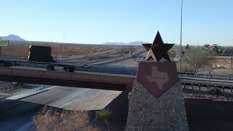
panning drone view of the texas border, state line marker coming from anthony, new mexico entering el paso county - us highways map stock videos & royalty-free footage00:06Panning Drone View of the Texas Border, State Line Marker Coming From Anthony, New Mexico Entering El Paso CountyTexas, Driving, Dallas - Texas
the steam age (history of transportation, part i) - part 8 of 29. describes the swift development of transportation in the united states from the time of the indians to the coming of the automobile. historical reenactments and unusual prints of the period - us highways map stock videos & royalty-free footage00:36The Steam Age (History of Transportation, Part I) - part 8 of 29. Describes the swift development of transportation in the United States from the time of the Indians to the coming of the automobile. Historical reenactments and unusual prints of the periodMississippi, 1950-1959, USA
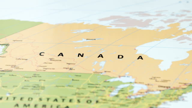
north america canada on world map - us highways map stock videos & royalty-free footage00:12NORTH AMERICA Canada on World MapCanada, Map, USA
usa map by states - us highways map stock videos & royalty-free footage00:20USA map by statesMap, USA, Canada
usa attack to iran - 4k - us highways map stock videos & royalty-free footage00:12USA Attack to Iran - 4KIran, USA, Computer Crime
usa map by states - us highways map stock videos & royalty-free footage00:19USA map by statesUSA, Map, Canada
united states of america map - us highways map stock videos & royalty-free footage00:20United States Of America MapMap, USA, Election
united states of america map - us highways map stock videos & royalty-free footage00:30United States Of America MapUSA, Geographical Border, Airport
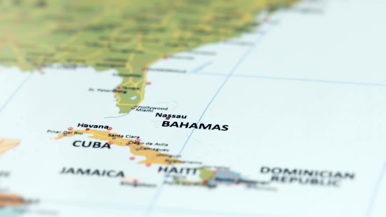
north america bahamas on world map - us highways map stock videos & royalty-free footage00:11NORTH AMERICA Bahamas on World MapMap, Caribbean, Bahamas
usa attack to iraq - 4k - us highways map stock videos & royalty-free footage00:12USA Attack to Iraq - 4KUSA, Air Attack, Army Soldier
usa map by states - us highways map stock videos & royalty-free footage00:19USA map by statesMap, USA, Data
usa attack to china - 4k - us highways map stock videos & royalty-free footage00:12USA Attack to China - 4KUSA, War, World Map
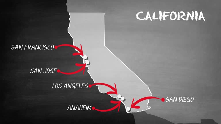
california map - us highways map stock videos & royalty-free footage00:30California mapMap, Sketch, California
"report from berlin-paris-europe's days of firmness and challenge" / arrival of gen. matthew ridgway, supreme allied commander in europe, followed by... - us highways map stock videos & royalty-free footage02:22Ridgway greeted by Eisenhower with Pleven and Gruenther; NATO leaders sign European Defense Pact; Berlin scenes from 1948Cold War, Germany, Berlin
california to new york - us highways map stock videos & royalty-free footage00:07california to new yorkMap, California, Airplane
and mexico linked by new super-highway" / vs cars driving over highway bridge over rio grande river between laredo, tx, and nuevo laredo, mexico /... - us highways map stock videos & royalty-free footage00:40Shots in Laredo, TX, of highway connecting US to Mexico CityMexico, Map, 1930-1939
usa on world map stock video - us highways map stock videos & royalty-free footage00:12USA on World Map stock videoUSA, Map, Identity
aerial views of traffic on freeways depicting an in-car radio audience, a map of the wjr radio coverage area including michigan, indiana, ohio and... - us highways map stock videos & royalty-free footage00:26Aerial views of traffic on freeways and a map of the WJR Radio coverage area, Detroit, MI, USADetroit - Michigan, Map, Traffic
men walking across the land superimposed over a map of the united states / men working construction sites, lifting timber, pulling ropes, swing axes... - us highways map stock videos & royalty-free footage01:31WPA highways and streets are createdRoad Construction, WPA
earth connections. us. aerial, maritime, ground routes and country borders - us highways map stock videos & royalty-free footage00:12Earth connections. US. Aerial, maritime, ground routes and country bordersMap, Commercial Airplane, World Map
john charles freãåmont - part 32 of 32. dramatizes scenes from john charles freãåmont's three expeditions into the west, and presents him as the first united states senator from california, as general of union forces in missouri during the civil war, a - us highways map stock videos & royalty-free footage00:28John Charles FreÃÅmont - part 32 of 32. Dramatizes scenes from John Charles FreÃÅmont's three expeditions into the West, and presents him as the first United States Senator from California, as general of Union forces in Missouri during the Civil War, aUSA, Map
the gasoline age (history of transportation, part ii) - part 5 of 23. this film describes the rapid changes that have taken place in the transportation of the united states since the coming of the automobile. describes the growth and decline of railroads, - us highways map stock videos & royalty-free footage00:17The Gasoline Age (History of Transportation, Part II) - part 5 of 23. This film describes the rapid changes that have taken place in the transportation of the United States since the coming of the automobile. Describes the growth and decline of railroads,Road Map, USA, Highway
smart transportation in modern city - us highways map stock videos & royalty-free footage00:12smart transportation in modern cityMap, Car, USA
ms female passenger reading map in car driving on highway / belt parkway, new york state, usa - us highways map stock videos & royalty-free footage00:21MS Female passenger reading map in car driving on highway / Belt Parkway, New York State, USAMap, USA
far western states (2nd edition) - part 18 of 19. surveys the region's geography, history, agriculture, and natural resources and describes the far west's enormous growth and commercial expansion in recent decades - us highways map stock videos & royalty-free footage00:32Far Western States (2nd edition) - part 18 of 19. Surveys the region's geography, history, agriculture, and natural resources and describes the Far West's enormous growth and commercial expansion in recent decadesArchival, 1950-1959, Old-fashioned
panning drone view of the texas border, state line marker coming from anthony, new mexico entering el paso county - us highways map stock videos & royalty-free footage00:11Panning Drone View of the Texas Border, State Line Marker Coming From Anthony, New Mexico Entering El Paso CountyEl Paso - Texas, Highway, Texas
gps city map navigation with route stock - us highways map stock videos & royalty-free footage00:12Gps city map navigation with route stockMap, Direction, Animated Video
4k africa map links 4k with full background details - us highways map stock videos & royalty-free footage00:204K Africa Map Links 4K with full background detailsAfrica, Map, African Culture
yemen, red sea, indıan ocean, suez canal map, 4k resolution - us highways map stock videos & royalty-free footage00:15Yemen, Red Sea, Indıan Ocean, Suez Canal Map, 4K ResolutionRed Sea, Map, Suez Canal
gps city map navigation with route - us highways map stock videos & royalty-free footage00:12Gps city map navigation with routeDirection, Map, Driving
4k spain map links 4k with full background details - us highways map stock videos & royalty-free footage00:204K Spain Map Links 4K with full background detailsMap, Earthquake, Internet
iran attack to usa - 4k - us highways map stock videos & royalty-free footage00:12Iran Attack to USA - 4KDrone, USA, Iran
far western states (2nd edition) - part 17 of 19. surveys the region's geography, history, agriculture, and natural resources and describes the far west's enormous growth and commercial expansion in recent decades - us highways map stock videos & royalty-free footage00:31Far Western States (2nd edition) - part 17 of 19. Surveys the region's geography, history, agriculture, and natural resources and describes the Far West's enormous growth and commercial expansion in recent decadesMap, 1950-1959
what makes weather? (2nd edition) - part 22 of 24. vivid satellite footage, helpful animation, and live action and time-lapse photography show the working forces that produce weather. the film examines the movement of winds and air masses caused by the un - us highways map stock videos & royalty-free footage00:35What Makes Weather? (2nd edition) - part 22 of 24. Vivid satellite footage, helpful animation, and live action and time-lapse photography show the working forces that produce weather. The film examines the movement of winds and air masses caused by the un1980-1989, Office, Weather
city map navigation motion animation - us highways map stock videos & royalty-free footage00:20City map Navigation Motion AnimationMap
united states of america map - us highways map stock videos & royalty-free footage00:20United States Of America MapMap
close angle of map, directions, diagram, or escape route on paper napkin. arrows on map. hands hold napkin down. - us highways map stock videos & royalty-free footage00:08CLOSE ANGLE OF MAP, DIRECTIONS, DIAGRAM, OR ESCAPE ROUTE ON PAPER NAPKIN. ARROWS ON MAP. HANDS HOLD NAPKIN DOWN.Map, Archival
riyadh capital city of saudi arabia road sign over the blue cloudy sky - stock video - us highways map stock videos & royalty-free footage00:20Riyadh capital city of Saudi Arabia road sign over the blue cloudy sky - Stock videoMap, Riyadh
amman capital city of jordan road sign over the blue cloudy sky - stock video - us highways map stock videos & royalty-free footage00:20Amman capital city of Jordan road sign over the blue cloudy sky - Stock videoJordan - Country, Map, Amman
panning drone view of the texas border, state line marker coming from anthony, new mexico entering el paso county - us highways map stock videos & royalty-free footage00:06Panning Drone View of the Texas Border, State Line Marker Coming From Anthony, New Mexico Entering El Paso CountyTexas, Map, El Paso - Texas
wonderlust - usa, road trip, maps on dashboard as we drive along freeway - us highways map stock videos & royalty-free footage00:10Wonderlust - USA, Road Trip, Maps on dashboard as we drive along freewayMap
airplane map route - us highways map stock videos & royalty-free footage00:29airplane map routeMap, Connection, Commercial Airplane
traffic on highways and suburban roads with various dangerous situations caused by careless drivers, id, us, 1960. - us highways map stock videos & royalty-free footage00:35Various road hazards, ID, USSuburb, Car, Highway
truck with god bless america sign driving on interstate 81 south bound in virginia - us highways map stock videos & royalty-free footage00:29Truck with God Bless America sign driving on Interstate 81 south bound in VirginiaUSA, God Bless America
close angle of television monitor in darkened control room. see map of seattle in crosshairs with university of washington, mountlake, freeways, roads and lakes represented. pans down, left and right to other monitors with aerial views of seattle. gps de - us highways map stock videos & royalty-free footage00:25CLOSE ANGLE OF TELEVISION MONITOR IN DARKENED CONTROL ROOM. SEE MAP OF SEATTLE IN CROSSHAIRS WITH UNIVERSITY OF WASHINGTON, MOUNTLAKE, FREEWAYS, ROADS AND LAKES REPRESENTED. PANS DOWN, LEFT AND RIGHT TO OTHER MONITORS WITH AERIAL VIEWS OF SEATTLE. GPS DEHighway, Washington DC, Day
argentina tittle road sign over the blue cloudy sky - stock video - us highways map stock videos & royalty-free footage00:20Argentina tittle road sign over the blue cloudy sky - Stock videoSomaliland, Map
san francisco popular city of california usa road sign over the blue cloudy sky - stock video - us highways map stock videos & royalty-free footage00:20San Francisco Popular City of California USA road sign over the blue cloudy sky - Stock videoMap, California, San Francisco - California
op down aerial drone tracking shot: white autonomous self driving car moving through city. concept: artificial intelligence scans surrounding environment, detecting cars. - us highways map stock videos & royalty-free footage00:20op Down Aerial Drone Tracking Shot: White Autonomous Self Driving Car Moving Through City. Concept: Artificial Intelligence Scans Surrounding Environment, Detecting Cars.New York City, Technology, Surveillance
maps & locations blackboard line animation with alpha - us highways map stock videos & royalty-free footage00:08Maps & Locations Blackboard Line Animation with AlphaMap, Mobile App, Icon Symbol
texas border sign in new mexico - us highways map stock videos & royalty-free footage00:10Texas Border Sign in New MexicoTexas, Map, Driving
car and truck commerce traffic global map - us highways map stock videos & royalty-free footage00:13Car and truck commerce traffic global mapSmart City, USA
chaotic scene unfolded on a houston freeway on monday, may 12, as a sedan being improperly towed at highway speeds swerved wildly through traffic. x... - us highways map stock videos & royalty-free footage01:20Scary Scene as Improperly Towed Car Swings Across Houston FreewayCar, Towing, Video
yemen, red sea, indıan ocean, suez canal map, 4k resolution - us highways map stock videos & royalty-free footage00:15Yemen, Red Sea, Indıan Ocean, Suez Canal Map, 4K ResolutionRed Sea, Violence, Map
the scenes depict boys looking at books, studying maps, writing and pointing to regions on the maps. there are also scenes of farm equipment in... - us highways map stock videos & royalty-free footage00:371960s: Apartment buildings by highway. High angle of city streetUSA
what makes weather? (2nd edition) - part 4 of 24. vivid satellite footage, helpful animation, and live action and time-lapse photography show the working forces that produce weather. the film examines the movement of winds and air masses caused by the une - us highways map stock videos & royalty-free footage00:36What Makes Weather? (2nd edition) - part 4 of 24. Vivid satellite footage, helpful animation, and live action and time-lapse photography show the working forces that produce weather. The film examines the movement of winds and air masses caused by the uneHighway
cute town map and gps system - us highways map stock videos & royalty-free footage00:15Cute Town Map and Gps SystemIsometric Projection, Road, Animated Video
kaliningrad city of ukraine - ukrainian region city town road sign over the blue cloudy sky - stock video - us highways map stock videos & royalty-free footage00:20Kaliningrad City of Ukraine - Ukrainian Region City Town road sign over the blue cloudy sky - Stock videoMap, Kaliningrad
sumy city of ukraine - ukrainian region city town road sign over the blue cloudy sky - stock video - us highways map stock videos & royalty-free footage00:20Sumy City of Ukraine - Ukrainian Region City Town road sign over the blue cloudy sky - Stock videoSumy, Map
busy highway from austin to elgin texas - us highways map stock videos & royalty-free footage00:09Busy highway from Austin to Elgin TexasHighway, Texas
close angle of map of washington d.c. written on with marker. arrows. plans. could be spy or terrorist plans. gloved hand points out route on map. - us highways map stock videos & royalty-free footage00:19CLOSE ANGLE OF MAP OF WASHINGTON D.C. WRITTEN ON WITH MARKER. ARROWS. PLANS. COULD BE SPY OR TERRORIST PLANS. GLOVED HAND POINTS OUT ROUTE ON MAP.Map, Spy, Washington DC
mayotte tittle road sign over the blue cloudy sky - stock video - us highways map stock videos & royalty-free footage00:20Mayotte tittle road sign over the blue cloudy sky - Stock videoMap, Mayotte
venice popular city of italy road sign over the blue cloudy sky - stock video - us highways map stock videos & royalty-free footage00:20Venice Popular City of Italy road sign over the blue cloudy sky - Stock videoMap
são paulo popular city of brazil road sign over the blue cloudy sky - stock video - us highways map stock videos & royalty-free footage00:20São Paulo Popular City of Brazil road sign over the blue cloudy sky - Stock videoMap
los angeles popular city of california usa road sign over the blue cloudy sky - stock video - us highways map stock videos & royalty-free footage00:20Los Angeles Popular City of California USA road sign over the blue cloudy sky - Stock videoCalifornia, Map
praia capital city of cape verde road sign over the blue cloudy sky - stock video - us highways map stock videos & royalty-free footage00:20Praia capital city of Cape Verde road sign over the blue cloudy sky - Stock videoRoad, Map
moroni capital city of comoros road sign over the blue cloudy sky - stock video - us highways map stock videos & royalty-free footage00:20Moroni capital city of Comoros road sign over the blue cloudy sky - Stock videoMap
jamestown capital city of saint helena road sign over the blue cloudy sky - stock video - us highways map stock videos & royalty-free footage00:20Jamestown capital city of Saint Helena road sign over the blue cloudy sky - Stock videoMap
buenos aires capital city of argentina road sign over the blue cloudy sky - stock video - us highways map stock videos & royalty-free footage00:20Buenos Aires capital city of Argentina road sign over the blue cloudy sky - Stock videoMap, Buenos Aires
hargeisa capital city of somaliland road sign over the blue cloudy sky - stock video - us highways map stock videos & royalty-free footage00:20Hargeisa capital city of Somaliland road sign over the blue cloudy sky - Stock videoSomaliland, Map
aden capital city of yemen road sign over the blue cloudy sky - stock video - us highways map stock videos & royalty-free footage00:20Aden capital city of Yemen road sign over the blue cloudy sky - Stock videoAden, Map
massachusetts city road sign over cloudy sky - stok video - us highways map stock videos & royalty-free footage00:20Massachusetts city road sign over cloudy sky - Stok videoMap, Massachusetts
minnesota city road sign over cloudy sky - stok video - us highways map stock videos & royalty-free footage00:20Minnesota city road sign over cloudy sky - Stok video
4k uk map links with futuristic hud virtual interface background detail - us highways map stock videos & royalty-free footage00:204K UK Map Links with Futuristic HUD Virtual Interface background detail
smart transportation in modern city - us highways map stock videos & royalty-free footage00:09smart transportation in modern cityMap, Digitally Generated Image, City
panning drone view of the texas border, state line marker coming from anthony, new mexico entering el paso county - us highways map stock videos & royalty-free footage00:08Panning Drone View of the Texas Border, State Line Marker Coming From Anthony, New Mexico Entering El Paso CountyTexas, El Paso - Texas, Map